As part of a regular series on the meaning of place names in the Territory, this latest edition focuses on changes due to satellite imagery and glacial retreat.
During a recent cruise as part of the International Thwaites Glacier Collaboration (ITGC), a new island was sighted from the US vessel Nathaniel B Palmer while off the coast by Thwaites Glacier in the Amundsen Sea. This island has been revealed as the ice shelf has retreated enough over the past decade to make it newlyidentifyable.
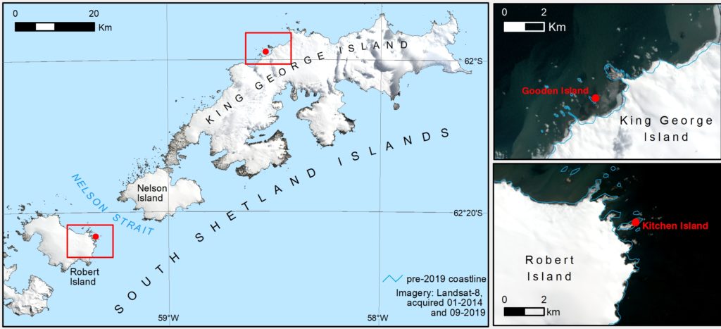
As earth observation technology has advanced, so has the ability to assess the geography of an area using satellite imagery. This, alongside glacial retreat and other processes, has led to a number of place-names needing a slight update. During the latest update to the South Shetland Islands 1:200,000 map in 2019, a few sites were revealed to be different features than were initially thought. Gooden Point (61°59’S, 58°32’20″W) on King George Island was found to actually be an island, having previously been identified as a point. This particular feature was named after K R Gooden, Base Leader at Admiralty Bay in 1951.
Similarly, on Robert Island, Kitchen Point was originally named Punta Labb by the CAE and later named Kitchen Point after Capt Joseph Kitchen, master of the sealing ship Ann, who visited the South Shetland Islands in 1821-22. It has been identified as an island in the latest coastline update.
More information on the South Shetland Islands 1:200,000 map can be found on the British Antarctic Survey website.
Find out more about place-names in the British Antarctic Territory.
Credit
With thanks to the British Antarctic Survey for the image and text.