As part of a regular series on the meaning of place names in the Territory, this latest edition focuses on areas relating to navigation in Antarctic waters.
RRS Ernest Shackleton has been a core part of British Antarctic Survey (BAS) operations for the last 20 years and left BAS service at the end of April.
The current focus on BAS ships and reliance on them for core logistics and science underlines the importance (and difficulty) of marine navigation in Antarctic waters. This theme is highlighted in place names across the Territory.
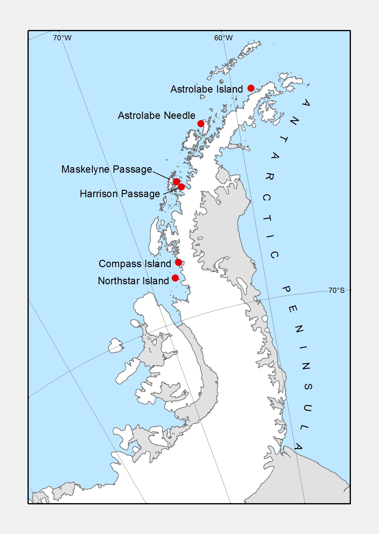
Compass Island (68°38’10”S, 67°47’09”W), in Marguerite Bay, was surveyed by FIDS from Stonington Island in 1948/49. It was initially named Compass Inlet due to difficulties experienced with compass bearings during the initial surveys. Nearby, Northstar Island (68°11’20”S, 67°06’02”W) was named after USMS North Star, one of the USAS ships to visit the area in March 1940.
Instruments and methods used to calculate a ship’s location are noted in place names. Astrolabe Island (63°18’58”S, 58°40’59”W) and Astrolabe Needle (64°06’54”S, 62°38’01”W) are both named after the FAE expedition ship L’Astrolabe, in operation in the 1837-40 expeditions. An astrolabe is a navigational instrument used to measure the altitude of celestial bodies above the horizon, and so provides a method to calculate latitude.
Harrison passage (65°54’32”S, 65°10’36”W) is named after John Harrison (1693-1776), an English horologist who provided the first solution to determining longitude at sea. Maskelyne Passage (65°51’00”S, 65°24’58”W) is named for Nevil Maskelyne (1732-1811), English Astronomer Royal, who started the Nautical Almanac in 1767.
Credit
With thanks to the British Antarctic Survey for the image and text.