As part of a regular series on the meaning of place-names in the Territory, this latest edition focuses on Sir James Clark Ross to mark the final season in Antarctica, after 30 years of service, of the Royal Research Ship (RRS) James Clark Ross.
RRS James Clark Ross is named after Admiral Sir James Clark Ross, R.N., Royal Navy explorer, and there are many places named in his honour across the continent as well as on South Georgia and in the Arctic.
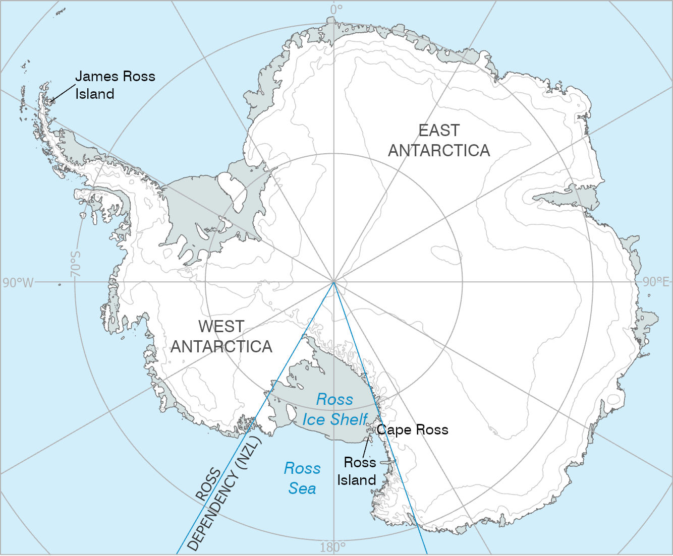
Within the British Antarctic Territory, James Ross Island (64°09’S, 57°45’W) was roughly charted by Ross during the 1839-1843 Ross Expedition and was originally shown as part of Trinity Peninsula, Palmer Land. It was further surveyed by the Swedish Antarctic Expedition (SwAE) in 1903 and determined to be an Island, then confirmed by Falkland Islands Dependency Survey (FIDS) in 1945-47.
The Ross Dependency comprises the sector of the continent between 160°E, and 150°W, south of 60°S. Within the Dependency are the Ross Ice Shelf, Ross Island and Cape Ross, all named after the famous explorer. The Ross Ice Shelf was discovered on January 28th 1841 by Sir James Clark Ross, who mapped the ice front eastward to 160°W.
For information about British Antarctic Territory place-names and guidelines on how to submit new proposals, visit the Committee website.
Credit
With thanks to the British Antarctic Survey for the image and text.